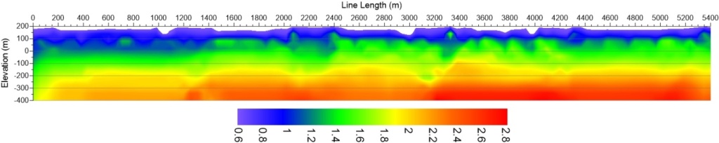
Seismic Refraction Survey measurements find applications in mapping near surface geological features, geotechnical investigations, mineral and oil & gas exploration, and archaeological studies. The seismic wave velocity is related to the mechanical properties of earth. Hence, seismic velocity coupled with complementary geological information (borehole logs, geological maps, outcrops data, etc) yield vital information on characterization of earth material, such as, compressional wave velocities of stratigraphic units, type of constituent rocks, degree of weathering, elastic properties, and rippability.
The seismic refraction method using compressional (P) waves is used to map geological conditions, such as, depth to bedrock, depth to water table, stratigraphy, lithology, structure, fractures, etc. In certain cases, seismic refraction measurements are done using shear (S) waves.
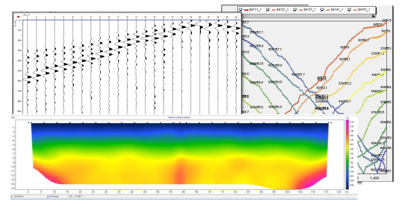
The Company provides the following services critical for various engineering projects using Seismic Refraction Survey Method:
- Mapping bedrock profile, and thickness of overburden
- Identification of fractures, and weak zones
- Studies of slope stability, and pipeline route
- Topography of ground water, and geological units
Estimation of soil elasticity modulii (such as Poisson’s Ratio, Young’s Modulus, Bulk Modulus, Shear Modulus), and rippability assessment in mines
The Company follows ASTM International Standard Designation D5777-11 Guide in acquisition, processing and interpretation of Seismic Refraction Survey data.